National Weather Service - Hastings, Courtesy
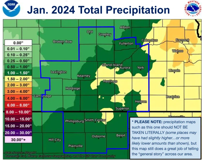
HASTINGS — The vast majority of the National Weather Service – Hastings coverage area saw above normal precipitation but there was a large disparity between the eastern and western counties.
Most of the area saw 0.45 to 1.45 inches, 80-260 percent above normal, NWS Hastings stated.
The areas with the highest precipitation totals included Tobias, in Saline County with 2.32 inches, Chester in Thayer County with 1.96 inches, Benedict, in York County with 1.92 inches and Osceola, in Polk County with 1.84 inches.
The areas with the lowest precipitation totals included Beaver City with 0.20 inches, Lexington with 0.22 inches, Elwood with 0.32 inches, Edison with 0.33 inches and Harlan County Lake with 0.39 inches.
As for the Tri-Cities, the official totals were as follows:
- Grand Island: 1.34 inches, 221 percent of normal and the 10th wettest on record
- Hastings: 1.05 inches, 191 percent of normal and tied for the 15th wettest on record
- Kearney: 0.79 inches, 155 percent of normal and the 26th wettest on record
For reference, normal January precipitation across the NWS Hastings coverage area ranges from 0.40 to 0.70 inches, generally lower in the west and higher in the east.
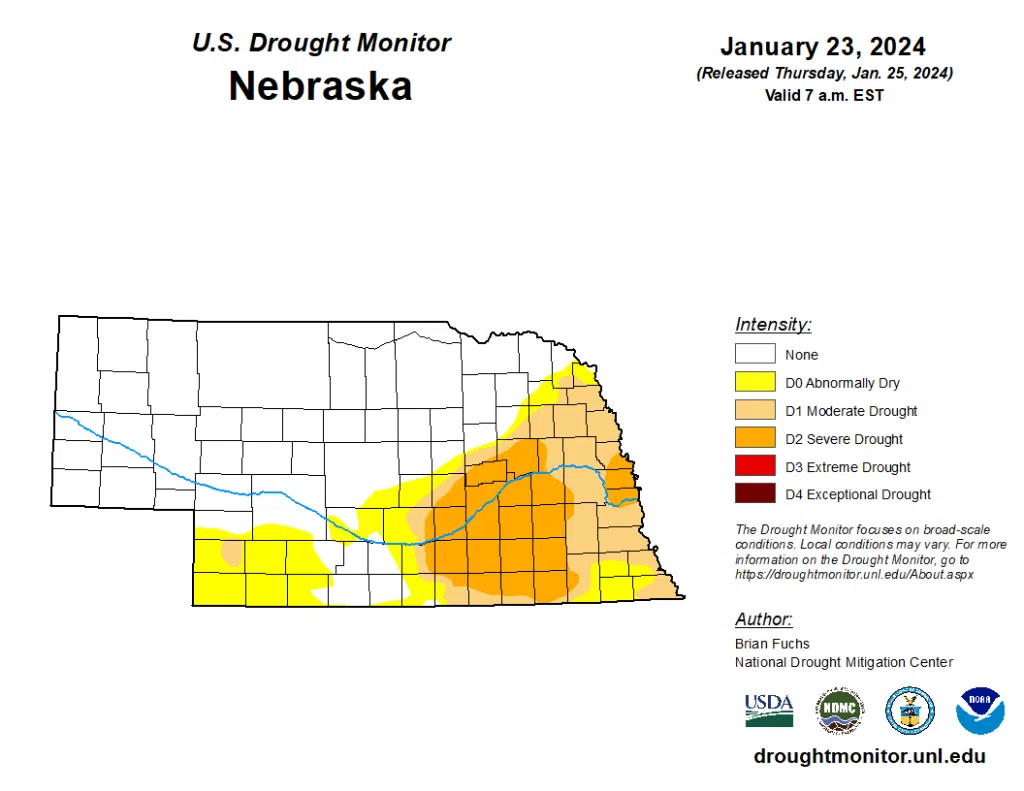
All the snowfall and precipitation has had a beneficial effect on the current drought conditions that have been in place across the state.
“The wetter pattern over the last several months allowed for a reassessment of the data to investigate potential changes in the drought intensity levels. It was noted that even though the last 9-12 months have a stronger signal toward the wet spectrum, there are still long-term issues that go out 24-36 months or more in much of the central Plains. In looking at the data, support for the existing extreme drought in eastern Nebraska was not there, so it was improved to severe drought this week,” the U.S. Drought Monitor stated in their update last week.
Exceptional drought, D4 and extreme drought, D3, conditions were removed from Nebraska. A large swath of severe drought, D2, conditions is assessed to exist over a portion of the of central and eastern Nebraska, including Hall and Adams counties.