HASTINGS — Severe thunderstorms caused swaths of damage throughout northern and central Nebraska during the evening of Friday, June 7.
Grand Island and areas east had been under an Enhanced Risk for severe weather while the rest of central Nebraska was under a slight risk.
A shortwave disturbance was set to move over the Plains and trigger thunderstorms that would move from northwest to the southeast. Convection began to occur in the Sandhills during the early afternoon hours and began propagating to the southeast.
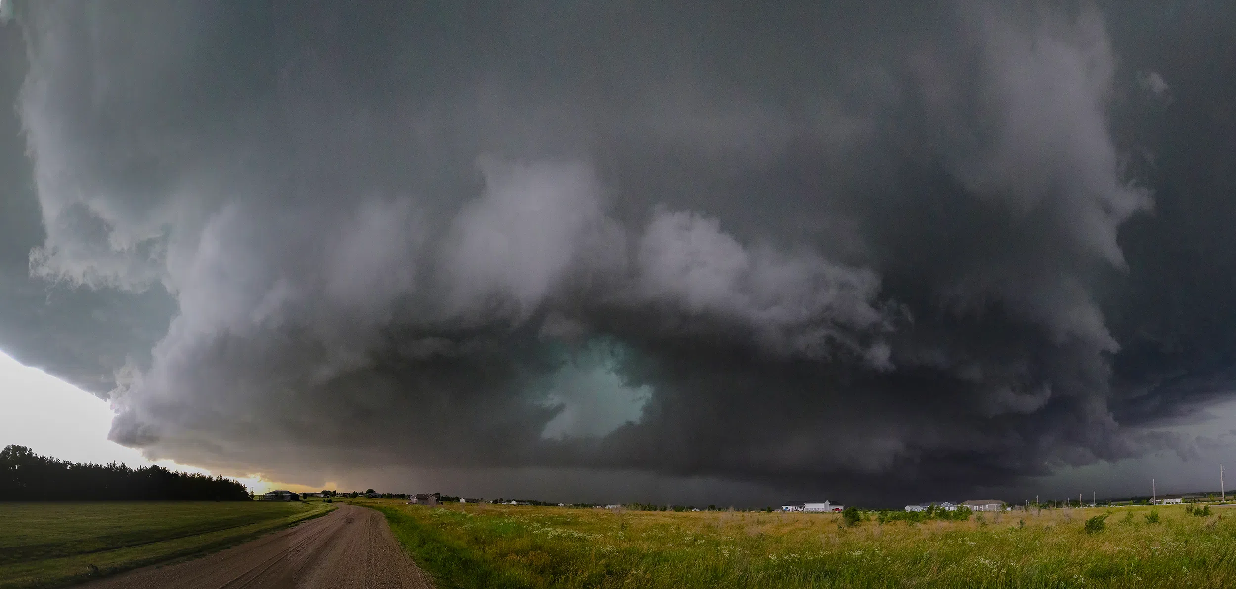
As storms approached Broken Bow, several storm mergers lead to a large supercell forming, while other multi-cell thunderstorms were present to the east of the storm.
According to Nathan Jurgensen, a lead meteorologist with the National Weather Service – North Platte, said that a wind sensor at Broken Bow recorded 60 mph gusts before the sensor itself was toppled.
Jurgensen said that NWS North Platte had a survey team out in the field in the Anselmo-Merna and Arnold area looking for evidence of a possible tornado that had been reported by storm spotters.
The only other reported damage in the NWS North Platte area was pivots overturned in the Burwell area.
As storms began to push farther southeast, an additional supercell formed to the west of the one that had passed through Custer County. This new supercell would move through Buffalo County and directly approach Kearney.
Storms were slowly forming into a larger line and several damage reports were noted in central Nebraska.
Michelle Schuldt, a meteorologist with the National Weather Service – Hastings, said that a six to eight mile wide and 12 miles long swath severe straight-line winds and hail destroyed crops in the Greely County area. Power lines were damaged, and pivots were overturned in the county, as well.
In Valley County, there was wind damage to grain bins, large trees uprooted, and trailers were pushed from where they had been parked.
Schuldt said that eight miles northeast of Wolbach, there was significant tree damage, along with flipped pivots.
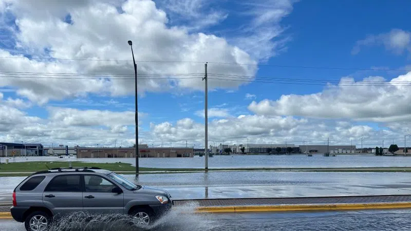
As the rear flank of the supercell thunderstorm approached the Kearney area, there was significant rainfall that occurred in town that lead to a period where the roads were flooded.
Some enterprising residents took to the waterlogged streets in a kayaks.
There was also wind damage in town, with tree limbs being blown down and the sign of the Kearney Area Chamber of Commerce being nearly blown off its foundation.
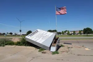
Damage caused to the Kearney Area Chamber of Commerce’s sign from the June 7 storm, (Brian Neben, Central Nebraska Today)
As the larger storm complex began to merge into a line, Phelps County Emergency Management reported two miles of downed power lines that had been snapped in half. There was also a barn that appeared to have been destroyed by the winds.
Additional tree limb damage was reported in Kearney County as the storms advanced further to the south.