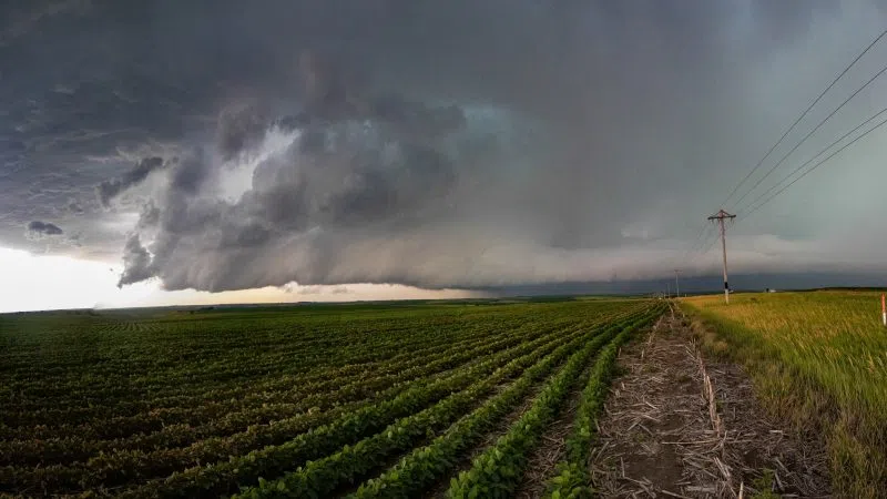
HASTINGS — Two brief, weak tornadoes occurred near Beaver City and Keene during the evening hours of Monday, July 1.
A Slight Risk for severe weather had been issued across central Nebraska for the late afternoon and evening of Monday. Storms were expected to initiate in southwest Nebraska and grow into a cluster or line as they moved east.
Thunderstorms initiated in northwestern Kansas and then tracked into Nebraska, numerous cells began to initiate in clusters and tracked to the northeast.
One cell began to display supercell characteristics and a tornado warning was issued just before 6 p.m. for the Beaver City and Oxford area.
The first tornado of the evening occurred at 5:51 p.m., three miles north northeast of Beaver City. The brief touchdown was reported by storm chasers.
No rating nor wind speed was assigned due to the lack of quality damage indicators in the area and then the tornado was rated EF-U.
An EF-U or Uknown, is a rating used to categorize tornadoes that cannot be rated due to a lack of damage evidence. This rating is for when a tornado caused no damage, was over open fields, there was video and photo evidence, but no physical markers.
This severe thunderstorm began to move along Highway 34 as it approached the Atlanta-Holdrege area and maintained a tornado warning.
A second EF-U tornado would occur one mile northwest of Keene in Kearney County at 7:07 p.m.
This brief touchdown was reported by storm chasers and an off-duty NWS employee. No rating or wind speed could be assigned due to lack of damage indicators.
Passing through the Axtell area, large tree limbs were blown down from trees into the streets and along the highway. This was likely due to straight line winds within the forward flank downdraft of the thunderstorm.
The storm also brought large amounts of rain to the area. Anew daily record for July 1 was set in Grand Island. The new record was 2.07 inches, the prior record set in 1962 was 1.20 inches.
Rainfall in other areas included over three inches northwest of Osceola, 3.5 inches in Riverdale, 3.0 inches in Holdrege, 2.3 inches in Kearney and 2.0 inches at York.
There was flooding reported in the area, Highway 92 in Polk County was closed west of Osceola and east of Shelby.
“Nebraska Department of Roads in Polk County has determined the best course of action at this time is to close Highway 92 from the West Osceola 81/92 Junction to the East Shelby 81/92 Junction due to flooding,” Polk County Emergency Management stated.


