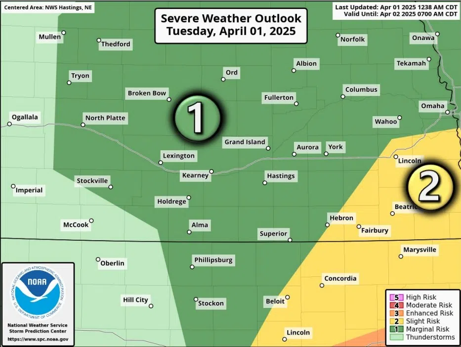
Severe weather risk for Tuesday, April 1, (NWS Hastings, Courtesy)
HASTINGS — While the overall risk for severe weather has been downgraded for Tuesday, April 1, the threat of hail and severe wind remains across parts of the region.
The Storm Prediction Center moved central Nebraska from a Slight Risk to a Marginal Risk, a one out of five, for severe weather. The downgrade owing to the uncertainty with how far north richer moisture will reach.
As of 8 a.m., dewpoints were only in the high 30s across the region, with dewpoints in the 50s and higher needed for more robust storms.
Per the National Weather Service – Hastings, the risk for severe storms still exists between 3 p.m. and midnight, with at least isolated to scattered storms developing over the region and generally track east with time.
“The initial storms are expected to develop in counties west of Highway 281, but the overall-greatest coverage of storms should eventually favor counties east of Highway 281, especially this evening. The majority of our area is currently assigned a Marginal Risk,” per NWS Hastings.
“The main hazards with any severe storms appear to be hail up to around ping pong ball size and wind gusts to around 60 mph,” NWS Hastings states.
Owing to the stronger winds, a Red Flag Warning has also been issued for Furnas and Harlan counties in Nebraska from 2 p.m. to 6 p.m., with wind gusts reaching 25 to 35 mph and relative humidity around 20 to 25 percent.


