
NORTH PLATTE — Amid the severe weather that impacted western and north central Nebraska, three landspout tornadoes touched down in Lincoln County on Wednesday, May 14.
A slight risk for severe weather had been issued for parts of western and north central Nebraska, due to an upper-level trough that was closing in on the area.
A sharp boundary set up in western Nebraska near North Platte and served as a focus for storm initiation during the afternoon hours.
Storms formed in the Sandhills initially, followed by development near North Platte, there was also a storm complex that formed near Loup City before slowly progressing north into the Burwell area.
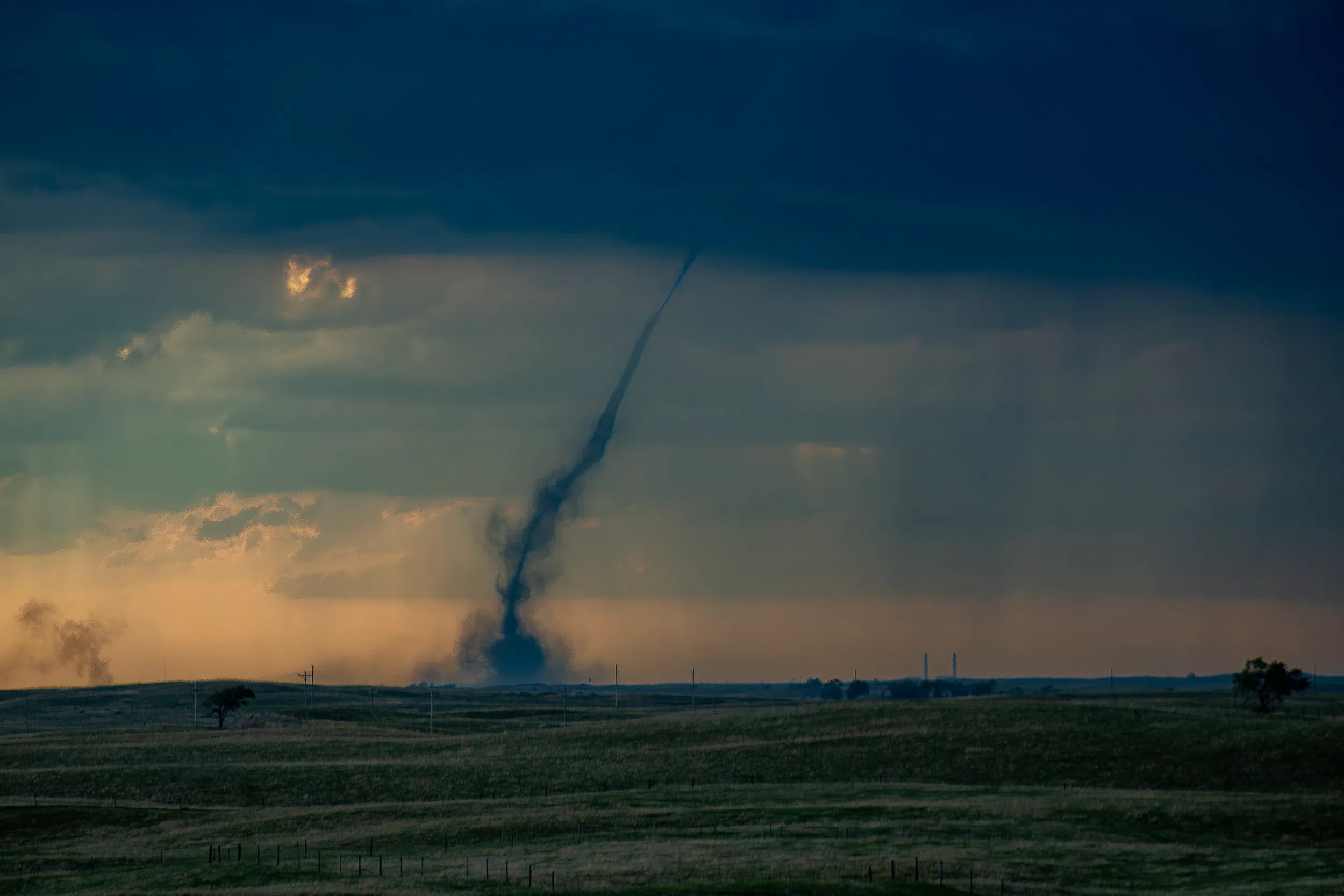
A storm that developed north of Wellfleet would go on to produce at least three landspout tornadoes, according to the National Weather Service – North Platte
Jaclyn Gomez, NWS North Platte meteorologist, said that the landspouts occurred between Wellfleet, Hershey and west of North Platte.
A landspout is a tornado that is not associated with the mesocyclone of a rotating supercell thunderstorm. They are formed when a storm cloud moves over a boundary and stretches vorticity upward and tightens it.
Landspouts generally are smaller and weaker than supercell tornadoes and do not form from a mesocyclone or pre-existing rotation in the cloud. Because of this lower depth, smaller size, and weaker intensity, landspouts are rarely detected by Doppler weather radar.
Landspouts share a strong resemblance and development process to that of waterspouts, usually taking the form of a translucent and highly laminar helical tube.
Not all landspouts are visible, and many are first sighted as debris swirling at the surface before eventually filling in with condensation and dust.
Gomez said that there have yet to be any damage reports associated with these tornadoes and there are no plans to survey, unless damage is reported.
There were other instances of severe weather in western and north central Nebraska on Wednesday.
Hail up to the size of 2.5 inches was reported near Burwell, while 1.75 inch hail was reported in Maywood, Wellfleet, Hershey and west of North Platte.
Gomez said that there was an 82-mph wind gust reported at the Grant airport, 79 mph north of Imperial, 72 mph in Imperial and 73 mph near Wallace. The damage was mainly regulated to large tree limbs being blown down.