
Pivot at sunset, (Brian Neben, Central Nebraska Today)
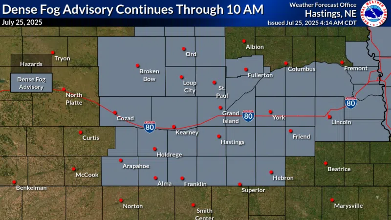
HASTINGS — There will be one last seasonably cool day with summer heat arriving for the rest of the forecast period and beyond for central Nebraska.
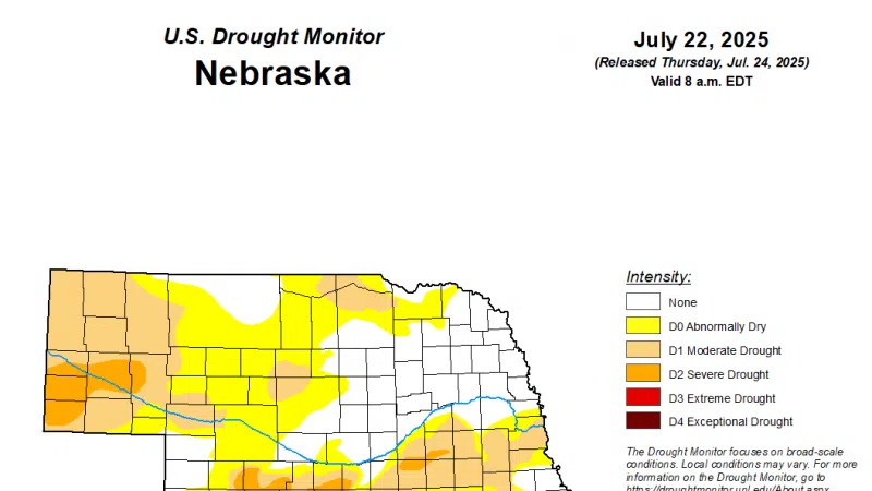
According to the National Weather Service – Hastings, an upper-level low pressure system will exit the region early this week and this will be replaced by ridge of high pressure that will result in rapidly rising temperatures and increased dewpoints as southerly flow returns to the region.
The result will be far more humid and hot temperatures across central Nebraska.
Wednesday looks to be the warmest day of the work week with widespread high temperatures climbing into the mid-90s.
By late Wednesday night, the upper-level flow will flip more westerly, and this will allow for several weak disturbances to cross the region and introduce isolated and scattered precipitation chances.
Late into the forecast period, the high-pressure ridge will rebuild back into the Great Plains with potentially even warmer temperatures early next week.
NWS notes to enjoy the cool start to the week because summer-like temperatures will emerge mid-week with no significant relief in sight once they settle across the region.