
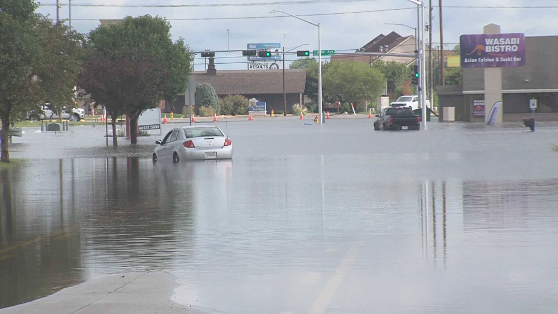
Diers Avenue flooded on June 26, (City of Grand Island, Courtesy)
GRAND ISLAND — Historic rainfall shattered the records in Grand Island after the community received over six inches of rainfall on June 25, which led to flooding throughout the community.
According to the National Weather Service – Hastings, the Grand Island Central Nebraska Regional Airport recorded total rainfall of 6.41 inches.
It was noted that this “shatters” the record of rainfall for June 25, with the old record being 1.55 inches which was set back in 1990. Grand Island precipitation records date back to 1895.
In addition, the rainfall in Grand Island broke the daily record for any day in June. The previous record was 4.18 inches set on June 15, 1990.
The rain fall total was only .9 inches from breaking the single day rainfall for any day of the year. The record is still held by May 11, 2005, when 6.50 inches fell, but the June 25, 2025, amount is now in second place.
The heavy rainfall caused flash flooding throughout Grand Island and a Flood Warning has been issued until 10 a.m. on Friday, June 27.
The counties and portions of counties under the warning include Hall, Howard, Merrick, Sherman, Adams, Buffalo, Franklin and Kearney.
Extensive flooding from Wednesday night’s rainfall will continue throughout Thursday as scattered amounts of three to eight inches fell across the region.
Flooding of small creeks and streams and rural county roads will continue. Some locations that will experience flooding include Grand Island, Ravenna, Wood River, Shelton, Kenesaw, Alda, Prosser and Norman.
“Turn around, don`t drown when encountering flooded roads. Most flood deaths occur in vehicles,” per NWS Hastings.
Konnor Stump, meteorologist with NWS Hastings, said that while Grand Island was the hotspot, with 6 to 7.8 inches falling in the metro area. He said a large swath from Kearney County to Nance County saw five or more inches. Stump said that Central City saw 7.3 inches.
Other areas that saw high amounts included Wood River, 6.29 inches; Genoa, 5.24 inches; Dannebrog, 5.21 inches; Gibbon, 5.20 inches; Kenesaw, 4.82 inches; Palmer, 4.65 inches; Cairo, 4.42 inches and Loomis, 4.39 inches.
Kearney saw between 2.6 and 3.2 inches, while Hastings recorded 1.8 to 2.1 inches
The rivers and streams northwest of Grand Island are rising the quickest, Stump said, despite the fact the peak rainfall did not fall here because the areas of northern Buffalo and Sherman County saw rain across Tuesday and Wednesday. He noted on the Platte River has filled but is not yet at any flood stage.
Stump said the NWS is concerned about Merrick County as it saw rainfall over six inches and flood waters fill flow from the west into the county.
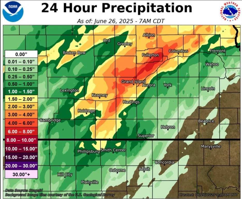
NWS Hastings, Courtesy