
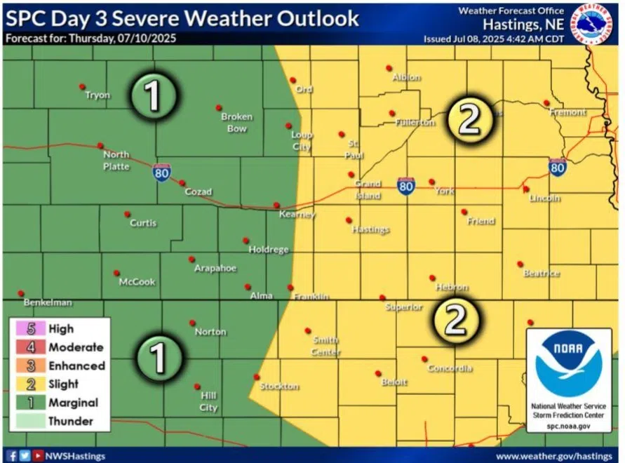
Slight Risk of severe weather issued for Thursday, July 10, (NWS Hastings, Courtesy)
HASTINGS — The risk for severe weather returns to parts of central Nebraska, mainly along and east of Highway 281, during the afternoon hours of Thursday, July 10.
The Storm Prediction Center has issued a Slight Risk, a two out of five, for areas of south-central Nebraska, including Grand Island and Hastings, along with all of eastern Nebraska.
According to the National Weather Service – Hastings, an upper-level shortwave disturbance is expected to pass over the area Thursday into Thursday night, which will serve as the trigger for storms.
Given the sufficient atmospheric instability, wind shear and mid-level lapse rates, storms are expected to be strong to severe.
Per NWS Omaha/Valley, the expected storm mode is still in question, if there will be more discrete storms or will a multi-cell cluster mode be more favored.
“The degree of instability and effective layer shear will support all modes of severe initially, with a tendency toward large hail and damaging winds with time,” per the SPC.
It was also noted that this set up looks to be favorable for excessive rainfall, given that precipitable water values look to near two inches.


