HOLDREGE — To say that it has been bone dry across central Nebraska this fall is an understatement, I hadn’t been on a true storm chase since July.
So when I checked the outlook for Monday, Oct. 21 and saw a Slight Risk for severe weather across central Nebraska, there was no chance I was going to waste this opportunity.
Of course, by this time of the year, severe weather chances have diminished notably from their high point in May and June.
However, as the weather pattern begins to change, the jet stream begins to migrate back south and storm chasers get what they call a “second season,” with some severe chances returning in late September and October.
The outlook for Monday was that a compact low pressure system would be moving out of the Rockies and straight across Nebraska.
With the southerly winds helping to increase the dewpoint and the forcing that the low would produce, severe weather chances…and the first precipitation in months returned to the area.
An initial wave of showers moved through the area during the morning and additional storm development was expected during the afternoon hours in south central Nebraska.
With the target area in my own backyard, I held my ground at work in Kearney throughout the day, checking the radar periodically to watch for storm development.
There was the chance for discrete storm development and the chances for tornado was not zero, but frankly I was just going to be happy to have a storm to look at, given that I hadn’t had a proper storm chase since July 6.
The precipitation was also going to be welcomed, the ongoing dry conditions had contributed to several high danger fire weather days and I always get nervous when the Red Flag Warnings come out.
Sure enough, the first echo tops of storms began to go up in north central Kansas and began tracking to the northeast.
After giving storms the chance to develop, I hit the road just before 5 p.m. One storm had grown in scale and was taking on a linear shape, with a bowing segment in the middle that was approaching Phelps County.
So discrete storm mode was not in the cards for me, but I know from experience that dramatic shelf cloud structures can occur on the leading edges of these linear thunderstorms.
I passed through Holdrege and noticed a farmer north of town who was cutting corn as quick as they could with the storm looming in the background. A word of advice, never ask a farmer about the weather – they are never happy with the current conditions…never.
With the line segment moving to the northeast, my plan was to get south of Atlanta and let the storm come to me.
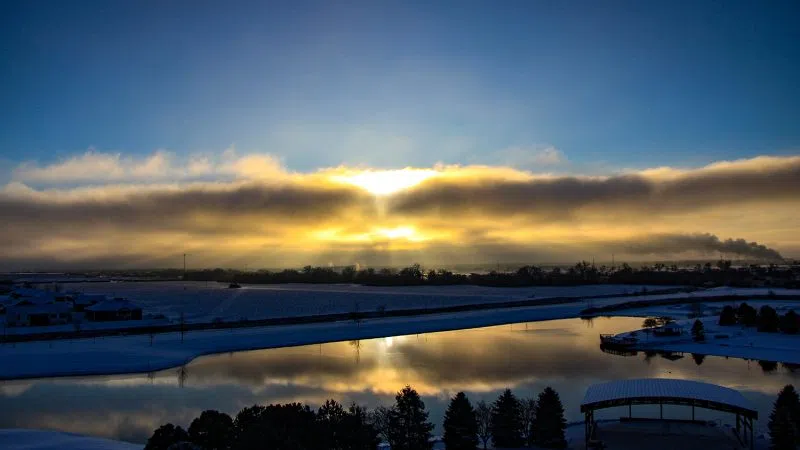
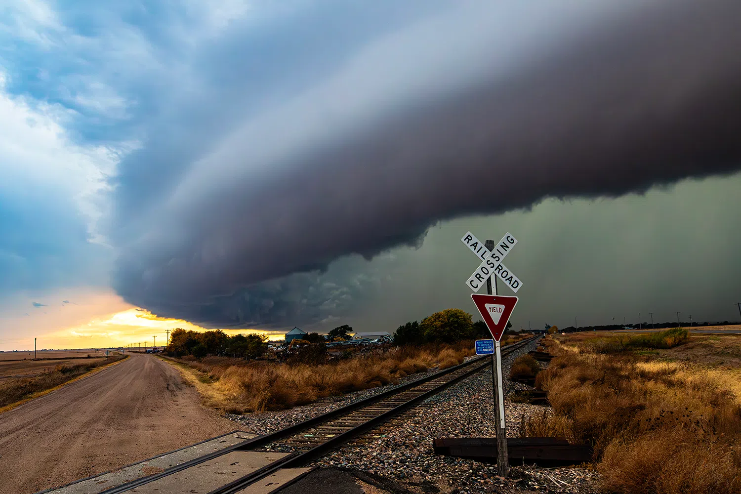
Sure enough, as I closed the distance, I could pick out the edge of a vast shelf cloud covering the horizon.
A shelf cloud is a low, horizontal, wedge-shaped arcus cloud attached to the base of the parent cloud, which is usually a thunderstorm cumulonimbus, but could form on any type of convective cloud.
Rising air motion can often be seen in the leading part of the shelf cloud, while the underside can often appear as turbulent and wind-torn. Cool, sinking air from a storm cloud’s downdraft spreads out across the land surface, with the leading edge called a gust front.
From a distance, these clouds can look like a low flying alien mothership. Let it close in and you get the sensation of what it would be like to be Jonah when he was swallowed by the whale.
I got into position just southwest of Atlanta and jumped out of the car with the shelf cloud approaching. The sight was dramatic, with the gust front closing in I could see the turbulent air rising underneath it.
Beyond that was the wall of rain that was right behind the gust front, that was the part I wanted to avoid. Driving through the equivalent of a waterfall on the road always rattles the nerves.
Chasing these linear storm segments usually devolves to a game of chicken. The most dramatic shots can be had when the gust front is right on top of you, but the core of precipitation is right on its heels.
So you sprint up to the gust front, wait as long as you dare, and then clear out of the way before you get swallowed by the whale.
I had clearly held my ground south of Atlanta for as long as I could because rain bands were starting to obscure the roadway.
I jogged back up the highway far enough to get more of the structure in view and paused again, repeating the cycle. I was able to grab some of the better shots of the night along a set of railroad tracks with the shelf cloud looming in the frame.
Not wanting to get bogged down in Holdrege, I sprinted away from the storm to give myself enough time to navigate my way through town.
This was a lesson learned from 2022 when I had not given myself enough time to get through Broken Bow and had to ride out the hail core of a supercell in town.
I got on the east side of Holdrege and found a harvested field that I could stop at. I had gained enough distance on the storm that it appeared to be this ground hugging mothership.
Once again I held my ground and let the storm come to me, I am sure I was quite the sight to the local drivers when I was standing on the roof of my car, camera in hand. Anything to get a better vantage point.
Not wanting my escape route to the north to be cut off, I finally called the chase and headed toward Funk to make the final turn north to Odessa. Luckily, the line segment was weakening and was starting to push almost due east.
This same chase in June likely wouldn’t have been much to write home about, but after several months off, it was good to get what felt like a final chance to document severe weather before the temperatures began to plummet.
I have a feeling the next major storm system will be bringing snow.
Editor’s Note: My name is Brian Neben and this is my sixth year as storm spotter and chaser. I write a personal column about each outing, as it helps to collect my thoughts and I have felt like people enjoy reading about my success or failures perusing this rather niche hobby.