HASTINGS — Near critical fire weather conditions will be possible on Tuesday, with thunderstorms expected to follow during the evening, some of which could be severe.
At the moment, a ridge of high pressure resides over the central Plains, and it is expected to shift east, putting the area under southwest flow aloft.
Highs today are expected to be in the mid-70s, typical high temperatures for this time of year range from the upper 50s to the lower 60s.
On Tuesday, a low-pressure system will develop on the lee side of the Rockies and lift northeast throughout the day.
Strong southerly winds will gust as high as 50 mph and relative humidity values will range from 20 to 30 percent.
“With the warmer weather, dry conditions and gusty winds, there are some concerns that any fires that are able to spark will spread rapidly, despite not meeting true Red Flag Warning criteria in some locations,” according to the National Weather Service – Hastings.
There is a potential for blowing dust along the Nebraska-Kansas state line during the afternoon.
The slower timing of a cold front passage through the forecast area will allow temperatures to warm to the upper 70s and mid-80s along a line along and north from Osceola to Cambridge.
Showers and thunderstorms are expected ahead of the cold front.
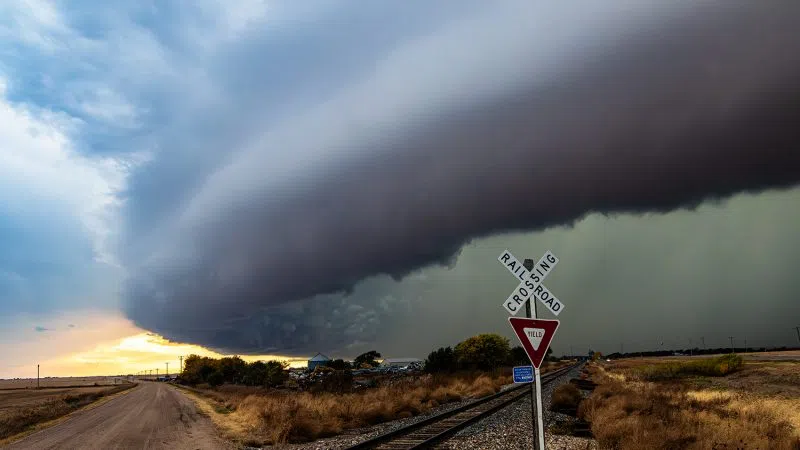
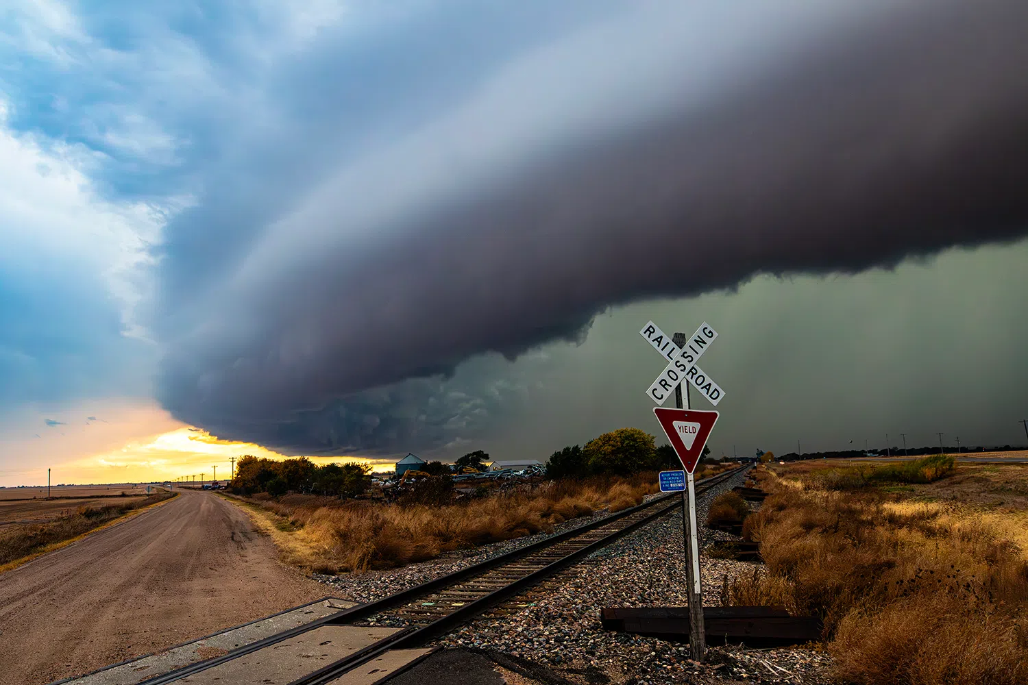
“Any storms that develop will have the potential of becoming strong to marginally severe. Hail to the size of quarters and winds gusting to 60 mph will be possible with any storms,” per NWS Hastings.
Rain will end west to east for most areas by Wednesday afternoon. A few areas may have some lingering showers heading into the late afternoon.
Wednesday into Thursday, an upper-level trough over the Rockies will list northeast across central Nebraska and there will be noticeably cooler temperatures for both days.
“Heading into the weekend, models continue to show the possibility for another round of precipitation as a trough moves into the region from the west. Considerable uncertainty in timing and location remains at this time. As temperatures currently stand, any precipitation at this point in time would fall as rain,” per NWS Hastings.