
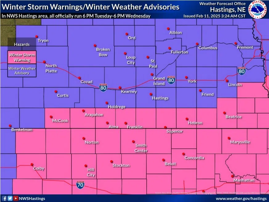
Winter Storm Advisory and Winter Storm Warnings issued for Tuesday, Feb. 11 and Wednesday, Feb. 12, (NWS Hastings, Courtesy)
HASTINGS — As a strong winter system descends upon the area, a Winter Weather Advisory has been issued for all of central and northern Nebraska, a Winter Storm Warning is in place to the south.
The entire National Weather Service – Hastings county warning area is under an advisory or warning. The Tri-Cites and surrounding areas are under the advisory while the counties along the Nebraska-Kansas line are under the storm warning.
The advisory and warning are in effect from 6 p.m. tonight until 6 p.m. on Wednesday. The counties in the advisory area will see around three to six inches of snowfall, while the warning area will see around six to eight inches.
Per NWS Hastings, the majority of the accumulating snow will fall between 9 p.m. Tuesday through noon on Wednesday. There is no freezing rain or ice expected.
Snow will be on the drier and fluffier side and not overly wet or heavy.
Winds will not be overly strong with sustained gusts from 10-15 mph and gusts up to 20-25 mph, so true blizzard conditions are not expected, but there could be minor drifting due to the lighter snow.
The coldest night of the week will occur Wednesday night into Thursday morning with sub-zero and single digits lows with wind chill values dropping as low as minus 10 to minus 20 degrees, nearing Cold Weather Advisory criteria.