
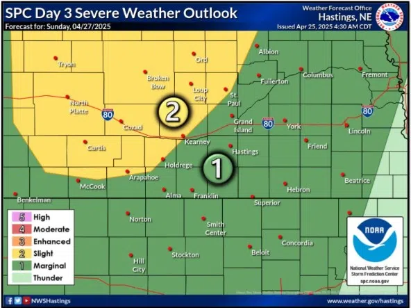
Slight Risk for severe weather issued for Sunday, April 27, (NWS Hastings, Courtesy)
KEARNEY — A Slight Risk for severe weather across parts of central and northern Nebraska has been issued for Sunday, April 27.
The Storm Prediction Center in Norman, Okla., has issued the slight risk, a two out of five, across parts of north and south-central Nebraska.
According to the National Weather Service – North Platte, the increased chances for severe weather will be due to an upper-level trough moving across the state.
In addition, a dry line will be present across the region which will help to create a boundary and area of higher dewpoints. This increase in moisture will allow for modest instability and with added wind shear around 60 mph will create an environment favorable for severe thunderstorms, as well as isolated supercells.
The main concern will be the location of the dry line and if the greatest instability can be tapped into by developing storms. However, if storms do develop, they will likely become severe. The main threats will be large hail and strong winds, but an isolated tornado could occur.
Given that this event is a few days away, there is still some inconsistency in the models. Some have been showing little in the way of storm development.
“This will continue to be monitored closely in the upcoming days with additional adjustments to the forecast likely,” per NWS North Platte, “Beyond Sunday, the active weather pattern continues as near-daily rain and thunderstorm chances are possible.”


