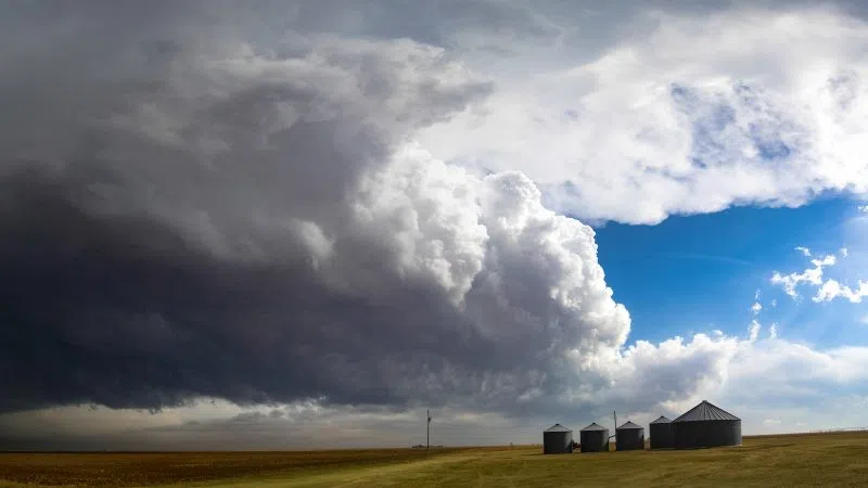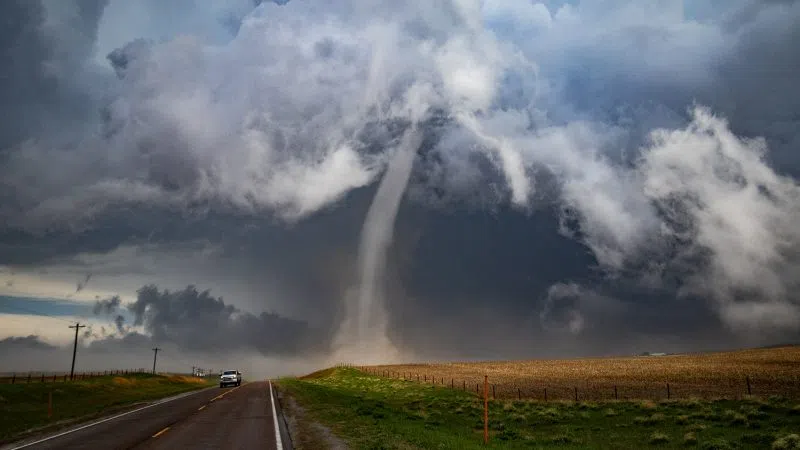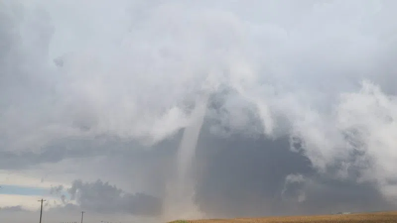
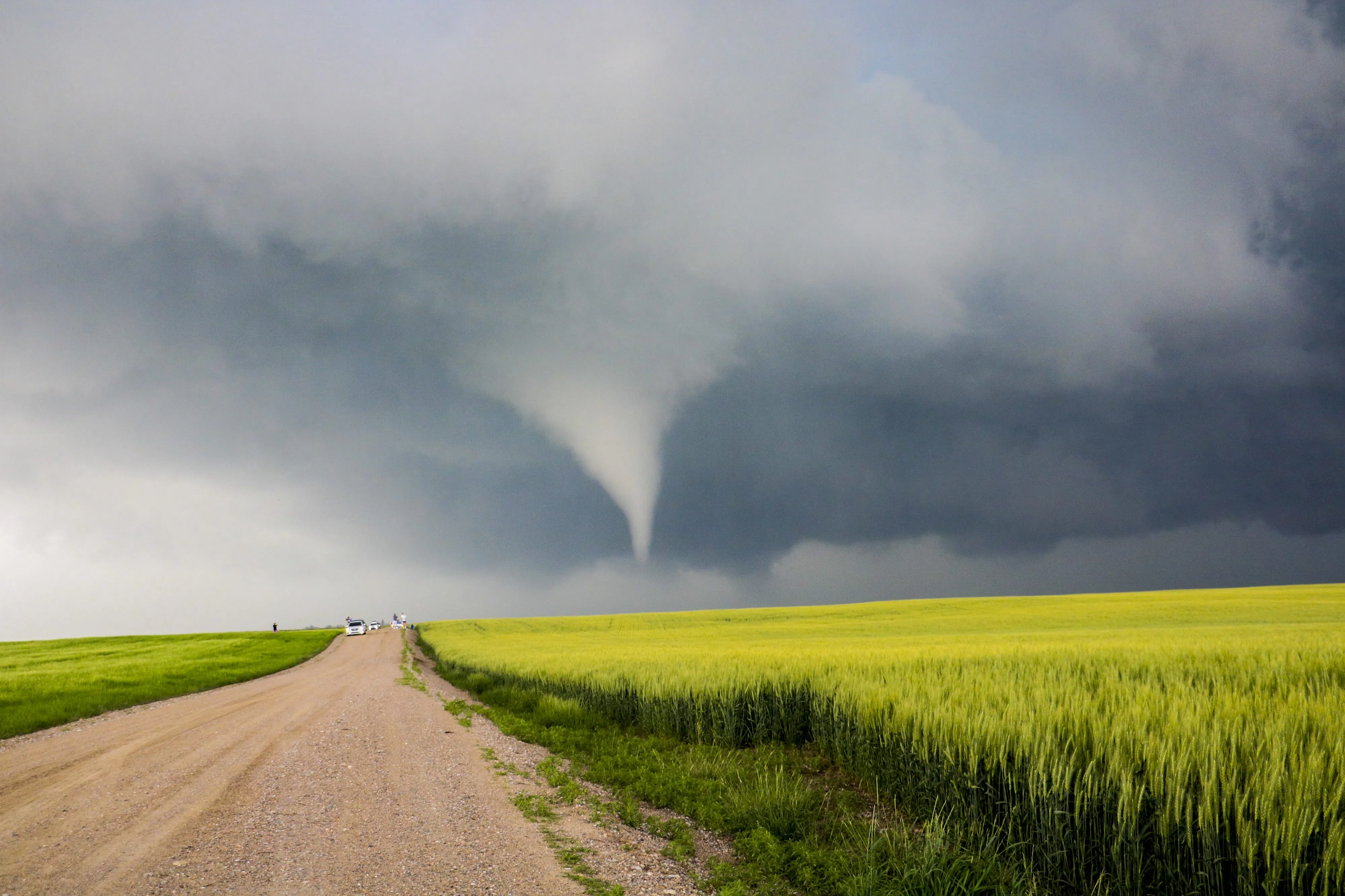
An EF-U tornado over rural Wyoming on June 23, 2023 (Brian Neben, Courtesy)
KEARNEY — As the area approaches the cusp of severe weather season, SKYWARN trainings have been held to teach spotters how to report the “ground truth.”
Every spring the National Weather Service – Hastings holds severe weather awareness talks that teach the basics about severe weather across their warning area, consisting of 24 counties in south central Nebraska, including the Tri-Cities and six counties in north central Kansas.
Mike Moritz, NWS HASTINGS Warning Coordination Meteorologist, gave the presentation at the Buffalo County Fairgrounds on Thursday, March 28, which was attended by over 60 people.
Moritz covered the basics of severe weather and how those treats can be via Doppler radar. NWS Hastings radar site is at Blue Hill.
Use of the radar does have some drawbacks.
The NWS Hastings radar site can see the lowest levels of the atmosphere closer to the radar itself. Due to the curvature of the Earth, the lowest the radar can scan over northwestern Buffalo County is between 6,000 and 7,000 feet.
That effectively means meteorologists cannot see the lower levels of the atmosphere, where many of the severe weather threats take place.
That is why reports from weather spotters are so important, they can provide the ground truth as to what is happening and help the NWS offer better and more informed warnings to the people in harm’s way.
There are different modes that can be used, the one people likely see most often is reflectivity, the amount of transmitted power returning to the radar after hitting precipitation.
Another mode is velocity, the radar can track a target’s motion that is along the direction of the radar beam. This is useful in determining the speed a storm is moving or strong straight-line winds that might strike an area.
There is also storm relative velocity; this is the base velocity with the average storm motion subtracted out. This is most useful for finding areas of rotation in a thunderstorm, which relates to tornado formation.
The presentation moved into the different types of thunderstorms. This type of storm is responsible for the majority of tornadoes in the United States – the supercell.

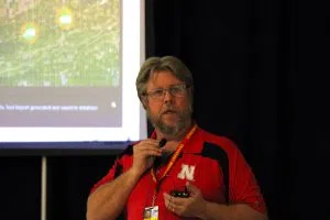
Mike Moritz, NWS Hastings Warning Coordination Meteorologist, (Brian Neben, Central Nebraska Today)
A supercell is a thunderstorm that is characterized by the presence of a mesocyclone, a deep, persistently rotating updraft. They are the least common type of storm but have potential to be the most severe. In addition to tornadoes, they can also produce large hail, torrential rainfall and strong winds.
Due to their organization, supercells have several identifying structures spotters can use out in the field to get their bearings and be able to tell if the storm is likely to produce a tornado.
The feature most easily seen in the anvil, the storms updraft collides with a stable layer of the atmosphere called the tropopause and the clouds spread out over the storm, sometimes rising to heights of 50,000 to 70,000 feet. For context, most passenger airliners cruise around 30,000 feet.
The forward flank downdraft (FFD) is generally the area of the heaviest and most widespread precipitation. For most supercells, the precipitation core is bounded on its leading edge by a shelf cloud that results from rain-cooled air within the precipitation core spreading outward and interacting with warmer, moist air from outside of the cell.
The rear flank downdraft (RFD) is a complex phenomenon and not yet fully understood. What is known is that this feature wraps around the updraft base, carrying precipitation with it. This causes the characteristic “hook echo,” return on radar.
The RFD usually contains winds blowing up to 100 mph as it descends to the ground. Moritz said the blowing dust and dirt can often be mistaken for a tornado; spotters should be looking for persistent rotation to identify a true twister.
A wall cloud is a feature that forms near the updraft and downdraft interface. Wall clouds are common and are not exclusive to supercells; only a small percentage produce a tornado, but if a storm does produce a tornado, it usually exhibits wall clouds that persist for more than ten minutes.
Another phenomenon covered during the presentation was gustnadoes.
These brief, surface-based vortexes are often mistaken for tornadoes by the public. They are formed by non-tornadic straight-line winds, usually in the gust front ahead of a thunderstorm, hence their name.
A gustnado has little in common with tornadoes structurally or dynamically regarding vertical development, intensity, longevity, or formative process.
One can avoid being fooled by ensuring that the ground circulation is in connected with a rotating cloud base. Double check the surface and clouds before making a tornado report.
When a thunderstorm begins dropping hail greater than one inch, the NWS will warn that storm as severe. When making reports about estimated hail sizes, the NWS says not to use marble size, as those can vary, but items like coins, ping pong balls, golf ball, or baseballs.
Lightning killed 13 people in the United States last year, with four deaths occurring in May and August each, people playing sports outside make up 14 percent of lightning fatalities. The NWS rule is, “When Thunder Roars, Get Indoors.”
When it comes to flash floods, It takes just 12 inches of rushing water to carry away most cars and just 2 feet of rushing water can carry away SUVs and trucks. “It is never safe to drive or walk into flood waters,” per NWS.
Buffalo County Emergency Manager Darrin Lewis also spoke at the presentation and gave an update on the outdoor siren project that has been ongoing.
Buffalo County Emergency Manager Darrin Lewis, (Brian Neben, Central Nebraska Today)
Lewis noted that thanks to recent upgrades, they now have much more control over the sirens and can activate any or all at once from a central system.
Lewis also stressed that the outdoor sirens are for people who are outdoors, they should not be relied upon in a residence. Those inside should have multiple means of receiving information when severe weather threatens.